16 August 2018

The Red Arrows


As I mentioned in my last post, on Halnaker Windmill, ‘something quite momentous and thrilling happened’ during our walk.

Jill and I were stomping along the public footpath that traces the line of the ancient Roman Road of Stane Street, battling our way through overgrown bracken and scratchy brambles, imagining ourselves walking in the footsteps of ancient peoples, enjoying the twittering of birds and buzzing of birds, when ...


Boom!


And boom again!


And again!

These were the Red Arrows, the Royal Air Force Aerobatic Team, performing one of their world-famous acrobatic displays for the ‘Festival of Speed’ taking place that day at nearby Goodwood. We’d had absolutely no idea to expect this but, by pure chance, we just happened to be in one of the very best possible places to watch their incredible manoeuvres. It was quite simply breath-taking!


15 August 2018

Halnaker Windmill


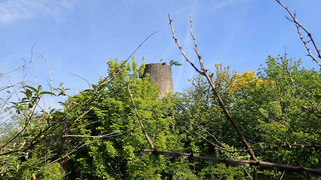
From Boxgrove Priory (see previous post), Jill and I headed north to find the building we’d really travelled across the county to see that day, Halnaker Windmill – we have a bit of a thing about windmills and this was one we’d been planning to visit for perhaps a year!


This was a Saturday so the roads were busy, in part due to a local event called ‘The Festival of Speed’ – not something we knew anything about, but we assumed that was why the first lay-by where we were hoping to park was full and so we carried on to the second. From there, we followed a public footpath alongside fields tall with golden cereal crops and, somewhat surprisingly, the symmetrical rows of grapevines. The footpath was ancient, part of the old Roman Road of Stane Street, which once carried legions, traders and assorted travellers from London to Chichester, just a few miles further south. Truth be known, this was probably an even more ancient path as many Roman Roads follow much older trackways where people have walked for thousands of years.


We could tell no Romans had walked this way for a while as the path was quite overgrown with brambles and bracken in parts, and we emerged at the other end with a few scratches for our trouble, but it was worth it. We had already gained some height in the landscape, and the views continued to improve as we pressed on up the wider, more well defined roadway to the windmill. (Something quite momentous and thrilling happened around this point but I’ll explain more in my next blog post.)

The top of Halnaker (pronounced Hanaker – the L is silent) Hill is a scheduled ancient monument as Neolthic people once constructed a causewayed enclosure here and, in more recent times, a World War Two observation post (for radio direction-finding) was also built here. But it was the windmill we wanted to see.

The first recorded windmill on this site was built in the 16th century, for the use of the Duke of Richmond’s local Goodwood Estate, though the present structure is not that old – it dates from the mid 1700s and continued to function until 1905, when it was struck by lightning.

The entry for the mill on the Historic England website explains its structure:
Red brick, covered with a thin coating of burnt Sussex tiles. Octagonal cap of beehive shape, made of sheets of metal, with finial. Sweeps intact. Fantail missing. The mill is only a shell with no internal floors or machinery.


The windmill was in a ruinous state when it was first restored in 1934, then needed restoration again in 1954 and once more in 2004. And it’s still being restored. An article in the Chichester Observer of 28 June 2018 notes that its tiles were replaced in October 2017, its white cap and balcony have just been repaired and repainted, and there is a photograph showing the recent refitting of the sails – so we were lucky to see it in such fine condition, though the building was still fenced off and lacked a proper door.


It’s wonderful to see this historic structure being so well cared for and conserved. Not only do visitors get a close-up look at this wonderful old building but, from its site so high on the South Downs, the panoramic views of the surrounding countryside are amazing. Both the windmill and those panoramas are well worth the climb up the hill to see.

12 August 2018

Boxgrove Priory and Church


As you approach the ruins of Boxgrove Priory, standing alone in a field, there’s an English Heritage sign. The text on the sign states:
Boxgrove Priory was founded in the 12th century. It replaced a small community of canons, probably associated with Boxgrove church since before the Norman Conquest in 1066. The priory has strong links with Lessay Abbey in Normandy with Boxgrove known as a ‘daughter house’ of Lessay. The priory was never large; by the 16th century it was responsible for a school and an almshouse. Along with many religious institutions, Boxgrove was disbanded during Henry VIII’s Dissolution of the Monasteries.


Reading the sign you might easily assume that the ruins you now see on this site are the remains of the whole priory but this isn’t so. And, very helpfully, someone has stuck a notice on the sign pointing out its shortcomings:
This picture shows only the Guest House.
The Priory Church is open every day.
Walk through the archway.
รจ


The English Heritage website provides a little more information:
At the northern edge of the site the ruin of the 14th century lodging house stands alone. It is roofless, but the north and south gable ends still stand to their full height. The building originally had two storeys, with an undercroft, or vaulted cellar, used for storage. The support for the vault of the undercroft can be seen clearly at the north end of the building.


After we’d had a good look at the Guest House, where beautiful remnants of sculptural details still remain, we followed the advice of the notice-sticker and walked across the field to the Priory Church.


As we walked through the thigh-high wildflowers, I was particularly impressed by the additional bird – a Kestrel – that flew in to adorn the church’s weathervane.


Inside the beautiful old church not only was there more information about the priory, including a scale model (there’s a plan of the full site here), but the church itself was a beautiful sight to behold. Dedicated to St Mary and St Blaise and dating, in part, to the early 12th century, the building is ‘a fine example of Norman (Romanesque) and Early English (Gothic) architecture’.


The painted ceiling is a delightful mix of the flowers and foliage of various types of plants, interspersed with the heraldry of the family of Thomas West and his wife – as the website explains, West was ‘9th Lord de la Warr, Lord of the Manor of Halnaker and patron of the priory, in the 16th century’.


Outside the church, you can still see other remains of the extended church and priory’s chapter house. English Heritage again:
The north wall of the nave forms part of the wall of the churchyard, and the footings of the south wall and one bay of the south arcade from the interior of the church can also be seen in the churchyard. One wall of the chapter house, where the monks would have gathered daily to have a chapter of the rule of St Benedict read to them and to discuss business, is attached to the north transept of the church. It has a central doorway with a window to either side. The remaining monastery buildings lay to the north of the church, surrounding the cloister, but do not survive above ground.


This was a beautiful place to explore so, if you’re in the area, do stop for a wander ... and don’t forget to follow the notice-sticker’s advice.

06 August 2018

The mystery of Burlow Castle


Three weeks ago, when I was in East Sussex, my friend Jill led me on a lovely long meander through the fields in the Cuckmere Valley. One of our motivations – though, truly, no motivation is needed to meander in this beautiful valley – was to take a look at the intriguing site labelled on the map as Burlow Castle. But was it ever really a castle? Experts and amateurs alike seem divided on the matter. Here’s what I found from a little digging – not literally, as the site is on private land so we couldn’t get too close.


First off, the spelling varies – I’ve found Burlow, Burlough and Burghlow, which certainly adds to your research time when you’re having to do three separate searches. Secondly, there are no actual physical remains of a castle on the site. Now I know that doesn’t necessarily mean there wasn’t once a structure there but even the blurb on the Historic England website acknowledges that a geophysical survey carried out in 1996 ‘indicated possible buried remains but provided no conclusive evidence’.   

Yet the Historic England website’s statement remains positive and very optimistic:
Despite some disturbance in the past, the motte and bailey castle known as Burlough Castle survives well. The earthworks of the castle form a prominent feature in the landscape. The site will contain [my emphasis] archaeological evidence and environmental information relating to the construction, use and history of the castle and the landscape in which it was constructed.

Hmmmm ... doesn’t sound like a terribly scientific analysis. The site itself was scheduled as an ancient monument way back in 1946 and that scheduling appears to have been based partly on its physical appearance – there is no denying the steep escarpment, commanding a fine view of the upper Cuckmere River, would be the perfect place to put a castle or similar defensive structure – and partly on archaeological evidence – ‘Fieldwalking in the area has recovered pieces of 12th and 13th century pottery. Other finds have included Prehistoric flints, axes and a pick as well as Iron Age or Romano-British potsherds’. Nice finds, though that doesn’t sound like a lot if this was the site of a castle. But the scheduling was also based on documentary sources. So what were they?


One of the oft-cited sources is Thomas Walker Horsfield, who published a series of volumes on the history and antiquities of this part of East Sussex. In his The History and Antiquities of Lewes and Its Vicinity (J. Baxter, Lewes, 1824, vol. 2, p. 8) he writes
Burlow Castle is said to have stood on an eminence east of the village. There are certainly now some foundations of walls to be discovered; and fifty years ago there were more, as appears from a drawing by Grimm, preserved in the British Museum. It is impossible, however, to discover either its extent or form, so completely has the hand of Time prevailed; nor has any document been found which can throw any light upon the subject.

The drawing by Grimm that Horsfield refers to is, officially, the ‘1787 – Ruins of Burlow Castle near Alfriston’ by Samuel Hieronymous Grimm, watercolour (174 x 253 mm), © British Library Board – shelfmark: additional MS 5671, item number: f. 60 (no. 107). The painting is in the collections of the British Library but there is an image of it on the Sussex Record Society’s website. Have a look – it’s the third image on the right and, if you click on it, you can see a larger version. Do you see any ruins? I see trees and hedgerows but I don’t see the more substantial walls Horsfield appears to refer to.


Horsfield returns to the topic of Burlow Castle in a later publication, his The History, Antiquities, and Topography of the County of Sussex (Sussex Press, Lewes, 1835, vol. 1, p. 320). In this work he admits that ‘Of its rise and fall, its form or use, tradition is silent and history is dumb’. Yet he goes on to propose, rather fancifully in my opinion, that Burlow was ‘one of the fortresses built by Henry VIII’, though he then undermines his own speculation by admitting that ‘Within the last three years the foundations have been excavated, and two large barns built of the materials. No discovery, except that of a few bones and broken pottery, was made.’ Once again, the lack of any significant discovery makes me doubt the presence of a substantial structure.


So, was there ever a castle on this impressive hilltop? Until such time as a very thorough archaeological excavation is undertaken, I don’t think anyone can say for certain. But, personally, I rather like the sense of intrigue and mystery that has developed around this place. I think Horsfield had succumbed a little to its romantic appeal and, if so, he certainly wasn’t the only one for, not only is Burlow the site of a putative castle, it also has its very own fairy story. This is from The Spectator newspaper, 25 April 1908, p. 27:

There is an old, old Sussex man who can point you out a favourite fairy haunt. You must call the little people “pharisees” when speaking of them, for that is the Sussex reduplicated plural of the word “fairy,” and all the old people speak of them as “pharisees.” The old Sussex man says that a familiar haunt of the pharisees was at Burlow Castle, which is “not much of a castle nowadays,” but which was “a famous place when there was a King in Sussex. A plough-man there was what was once ploughing there, and resting for his 'levener [eleven o'clock lunch] he suddenly heard a curious sound under the ground. He gave a start, and then he heard a liddle voice say, ‘Help! help!’ ‘What's up?’ says the plough-man, when the liddle voice says: ‘I've been baking and have broke my peel [a wooden shovel used by bakers for placing loaves in the oven], and I don’t know what to do, sure-lye.’ ‘Putt it up and I'll mend it,’ says the plough-man; and through a chink in the ground a liddle peel was putt up no bigger than a bren-cheese knife. So the plough-man he sets to work and mends the liddle peel, and then be putts it down again. And the next day a cup of delicious drink was putt up to the plough-man for his 'levener as a reward for mending the peel. But as this here plough-man was a-drinking from the cup he dropped it and broke it to shivers, and within a year he took and died."

Perhaps it’s a very good thing that the castle site is on private land, for who knows what might happen if we could walk there?

01 August 2018

Church of St Pancras, Arlington


As I mention in today’s earthstar wildlife blog, my friend Jill and I veered off our walk around Arlington Reservoir in East Sussex to investigate an interesting-looking old church, and this is it, the Church of St Pancras in Arlington. (As I was out and about photographing wildlife, I only had my long lens with me so you’ll have to forgive the lack of landscape shots – I focused on the details instead.)


Though the Lychgate is recent – beautifully crafted in 2000 to a design by church architect Ralph Wood ...


and the guttering was put up as recently as 1869, presumably during a period of restoration and refurbishment ...


parts of the church itself date back to Saxon times. (You can read about its history here.) The interior walls have mostly been white-washed but some traces of early decoration remain. 


There are painted flowers and crosses that date from the 14th century, and fragments of text, which have been labelled Elizabethan but apparently date from the 18th century – perhaps the style is Elizabethan. 

It’s hard to imagine what the interior must have looked like when the paintings were complete but it must certainly have been very lovely. 

There were many other fine relics and objects to admire – a finely carved screen, a Saxon window, lovely old tiles and beautiful stained-glass windows – but I think my three years’ living in Wales is having an effect on me as I was particularly enchanted by the two dragons on the pulpit. 

Though the pulpit itself is rather plain and has been dated to the 18th century, the dragons are a more recent embellishment. 

And not a sign of St George coming to slay them!

29 July 2018

Bow Bells mileposts

Number 43 is in the centre of Uckfield

I think many people will have heard of the Bow Bells, the bells on the Church of St Mary-le-Bow in London’s Cheapside: you can’t call yourself a true Cockney unless you were born within earshot of those bells ringing. But I wonder how many people know that the Bow Bells also have a part of play in measuring road distances.

On the old main road south from London to Lewes, the distances were once measured from the church door of St Mary-le-Bow, and mileposts – decorated with bells and marking the miles from the London church – were placed alongside the route so travellers knew how far they had journeyed, or had still to journey, if they were travelling towards London.

The Public Sculptures of Sussex website reports that the mileposts lining much of this road – now the A22 and parts of the A26 – are thought to be the longest sequence of mileposts in England, though sadly many have been removed, lost and/or stolen.

Photo © Peter Jeffery
(cc-by-sa/2.0)
geograph.org.uk/p/4541557
The mileposts were commissioned around 1754 by the Union Point to Langney Bridge Turnpike Trust, which was responsible for the maintenance and smooth running of the coach road. The posts were mostly made of cast iron and show a varying number of bells hanging from a bow – perhaps originally they all had five but some have eroded over time – dwindling in size from the top of the milepost to the bottom. 

At the top of the post, above the mileage figure, most of the posts show a single black dot (as shown in my photographs, of numbers 43 and 53) but those in the area around Halland, the 44 to 54 mileposts, have a buckle (as shown in the photo at right, by Peter Jeffery, used under a Creative Commons licence, as credited).

The buckle represented the Pelham family who were local landowners involved in financially backing the turnpike’s extension southwards in the 1750s. The Public Sculptures website again:

In 1356 at the battle of Poitiers a local knight Sir John Pelham together with Sir Roger de la Warr captured Jean the King of France, [and] because of this Sir John was given the King’s belt buckle as a badge of honour. This badge can be seen on many churches and buildings in the area around Laughton showing the influence and power of the Pelham family.

The number 53 milepost in my photograph is actually a replica from a museum in Lewes and, as the sign alongside explained:

Bow Bells milestone, Lower Dicker, Sussex.

This is a cast iron replica of a milestone from a series on the turnpike from Uckfield to Langney Bridge prior to 1810 and marks the distance of 53 miles to London.

The original of this post should bear the Pelham Buckle, intended as a mark of respect for this family and found on all mileposts situated on their land. In this case the buckle has been replaced with the more usual dot.

So far I have only photographed two of these historic mileposts, though I’ve seen a few more whilst travelling along that road, and I’ve managed to track down the location of several others that I hope to photograph in the future.

I find these physical reminders of Britain's history incredibly fascinating and hope they continue to be preserved (and not stolen!) for future generations to appreciate.

25 July 2018

East Sussex: fire insurance plaques


I spotted one of these fire insurance plaques the last time I was in East Sussex and during my latest visit I saw three more, two in the lovely old historic town of Alfriston and the other, the one shown at the bottom of this post, was attached to the 15th century Bridge Cottage in Uckfield.


Fire insurance only came into being after the devastating London fire of 1666. The Phoenix Fire Office was the first company formed, in 1680, followed soon afterwards by several other companies: established in 1710, the Sun Fire Office was one of the earliest, while Guardian Fire and Life was not founded until much later, in 1821.

Each of these insurance companies operated its own fire brigade so they needed a quick and easy way for their firefighters and assessors to identify which buildings were insured with their company. The plaques, originally made of lead but later also made of iron, tin and other materials, were the solution.

Some plaques, like the two Guardian signs shown here, simply displayed their company’s name and insignia; others, like the Sun Fire Office sign below, also included a number for easy reference to their customer ledgers.


Helpfully though, fire brigades didn’t just extinguish fires in buildings displaying their own plaques – after all, a fire could easily spread to an adjoining building that was insured by them – so they would fight a fire in any building displaying a mark and charge the other insurance company for their efforts.


27 May 2018

The Hayes Farm windmill


My eagle-eyed map-loving windmill-fan friend Jill can spot a windmill symbol on a map a mile away. Unfortunately, I didn’t show her the OS map until after our walk. Fortunately, the location of this particular windmill symbol is just a short distance from one of my regular walking routes so I added it on to my next visit. 


Fortunately, too, Jill didn’t miss much, as little can now be seen of the windmill, fenced off as it is behind high concrete posts strung with teal-plastic-covered wire netting and untended trees and shrubs. Though considered important enough to be Grade II listed and included on the Vale of Glamorgan’s own report of ‘County Treasures’, this important piece of Glamorgan’s industrial heritage has been badly neglected and is crumbling away.


The British Listed Buildings websiteprovides the following history of the windmill:

Hayes Farm was a model farm built 1813 at the end of the Napoleonic Wars by Evan Thomas of Llwynmadog Estate, Brecknockshire (1778-1832). Thomas bought the manor of Sully in 1812 and modernised the agriculture of the area according to best practice of the period. He brought together 7 farms into 2 model complexes managed by bailiffs: Cog Farm and Hayes Farm. The farmers were re-housed, field sizes increased, and facilities improved. Unusually for farms of the day, Hayes and possibly Cog had their own windmills to grind corn. Edward Harrie and William Stoddard are recorded as millers from 1821-28. The mill was of the revolving cap type and was later enhanced by horse walk and gearing, an oil engine installed c1902. The surrounding farm land was sold for industrial development in 1947 and the farm closed in 1950s.


And here is their description of the treasures of stone and metal, hidden away behind all that greenery:

Exterior
A stone tower mill with attached granary and barn. The windmill tower is of coursed rubble limestone, with patches of render; the cap is missing. There are iron joists of a former gantry at 2 thirds height, with a blocked access on the north side. Two windows, one above the other, are below this on the west side, and one and a doorway on the east. On the south, a door opens at first floor level into the granary.
The granary and barn form a long rectangular range, now roofless, of rubble stone with red brick dressings, mostly cambered-arched openings. Tall round -headed threshing arches opposite one another towards the centre. The building formerly had 2 floors, with a granary to the west and barn to the east. Lower level extensions were at each end, with cartsheds at right angles. Ruins of other buildings stand to the south and west, single storey range to W. The farmhouse is on the opposite side of Hayes Road.
Interior
Inside the tower the hurst frame retains 2 pairs of stones and stone nuts. The drive post is complete with wallower and spur wheel. Another drive passes through the wall.

Image grabbed from Google Earth

The Hayes Farm windmill is the only windmill in south Wales where there are still parts of the original machinery in situ yet, if nothing is done to maintain and conserve it, that machinery may soon be covered by the mill's collapsed rubble. Such a shame!


15 April 2018

Inns and their signs: Dorset, 1


A few months have passed since my excellent Christmas holiday in the Dorset – Hampshire – Somerset area, yet I haven’t written up these pub signs I photographed. Time to remedy that!


The Tippling Philosopher, Milborne Port
Now admittedly this 16th-century pub doesn’t have a very inspiring sign, especially considering its wonderful name, but it’s because of that name and the fact that the pub’s website actually has some good detail about its history that I’m including this one. Oh, and my friend Sarah and I also enjoyed a very nice lunch here.


To summarise the website: A tippler was an ale maker, and a local tippler was plying his trade on this very site from at least the mid 17th century. It is likely that the actual ‘Tippling Philosopher’ was one Robert Boyle, an eminent physicist, chemist and philosopher (who developed Boyle’s Law  and whose father Richard Boyle, 1st Earl of Cork, owned much of the land around Milborne Port. It seems Robert may have spent his evenings in this very alehouse, pontificating on his theories of life, the universe and everything. (The website has even more fascinating snippets of history if you’ve a mind to know more.) 


The Grosvenor Arms, Shaftesbury
Though there has been an inn (previously named The Red Lion) at this location since the medieval era, the current building is elegant Georgian, rebuilt and renamed The Grosvenor Arms when purchased by the Grosvenor family in 1820. 

The pub sign shows the family’s coat of arms, whose motto Virtus non stemma means Virtue, not pedigree. 

The hounds supporting the shield are Talbot dogs, which were introduced to Britain as hunting dogs by the Normans.


The George, Sherborne
The sign claims that The George is the oldest pub in Sherborne and that may well be true, as the British Listed Buildings website states that the building may date from the early 16th century, when it formed part of Becket’s Chapel or Hospital. The building has since been much altered, though it retains enough of its original features to maintain its Grade II listing. The sign shows a very well drawn version of the traditional story of St George slaying the dragon


The Half Moon, Sherborne
Unfortunately I’ve found no information about The Half Moon. The building looks old, though not as old as many in Sherborne town centre, and I assume the inn is named after its location in Half Moon Street. The pub’s sign also appears modern but I like its stylistic simplicity.


The Plume of Feathers, Sherborne
Dating from around 1590, The Plume of Feathers enjoys a prime location immediately opposite stunning Sherborne Abbey. 

It is a building of two parts: the left side of three storeys retains its 16th- or early 17th-century stone mullioned windows, while the right side, of two storeys, dates from some time in the 19th century. 

The plume of feathers symbol, and its accompanying motto Ich dien (I serve), can be seen adorning many British pubs, and is in common use in many other contexts: it can be seen on the reverse of the old 2 pence coins, it’s the logo of the Welsh Rugby team, and, of course, it’s the official badge of The Prince of Wales. You can read more about the origins of the badge here.


The White Hart, Sherborne
Like the plume of feathers above, the white hart is another very common inn name – the fifth most popular, in fact, and another that’s associated with royalty. The white hart was the personal badge of Richard II, and the creature itself (a leucistic adult male red deer) has a long and interesting place in Celtic and later Christian myth and history. Sherborne’s White Hart is set amongst a row of Grade-II listed buildings in the very heart of that historic town, and looks a very nice place to enjoy a glass or two.