Showing posts with label walks. Show all posts

06 March 2016

Cardiff walks: Forest Farm Nature Reserve

If you follow Earthstar, my daily nature blog, you’ll see that I delight in the trees, canals and wildlife of Forest Farm Nature Reserve, on Cardiff’s northern boundary. It’s a favourite place to walk and not just for me – you’ll encounter birders and fungi forayers, joggers, power walkers and dog strollers along its leafy trails.


As I don’t drive and depending on how energetic I’m feeling, I either walk from my flat in Roath Park (a 90-minute stroll) or I catch a train to Radyr (bottom left) or to Coryton (centre right of the map). (I have also walked back to Cardiff via the Taff Trail that borders the reserve alongside the River Taff, but that’s a story for another blog post.)


A. From Coryton, I can either walk around or across the large meadow that runs along the top of the site, or follow the path of the old railway track, a continuation of the track that now truncates at Coryton. It can be a bit muddy in winter but is lovely during the summer and autumn.


B. Longwood is an ancient broadleaf woodland, dominated by huge oak, ash and beech trees, and a walk along its top trail affords panoramic views west and south-west towards Radyr. The trail is quite narrow and the hillside below steep, so I also avoid this area when it’s very muddy and slippery, but the trees in this wood are majestic so it’s a beautiful place to wander.


C. A remnant of the Glamorgan Canal runs through Forest Farm. When it opened in 1798, it ran between Cardiff and the iron works at Merthyr Tydfil, carrying supplies in one direction and finished product in the other. It was also used by the coal mining industries in the Taff valley. Nowadays, it’s silted up, has fallen trees draped across its waters, and provides the perfect home and feeding place for a myriad of bird life, including stunning kingfishers.


D. It’s hard to imagine boats or barges ever using this old lock, but it would have been a busy place in the 1800s. As well as the lock itself, there is a separate smaller water channel that runs through this way, which provides pretty reflections in its still waters. Passers-by leave birdseed on the stone walls of the lock, making this a good spot for bird photography, and, as there’s a conveniently sited wooden bench, it’s a lovely spot to sit a while.


E. The waterway that bisects the southern part of the reserve is the Melingriffith feeder, which once provided water to the Melingriffith Tin Plate Works a little further down the Taff. Another pleasant trail runs alongside this stream and, from the trail, you can access the bird hides where you’re almost guaranteed to see the sudden turquoise flash that marks the kingfisher feeding.


F. Along the lower part of the Glamorgan Canal, you’ll see mallards and moorhen a plenty, the occasional heron and little grebe, as well as all the smaller birds that make this lovely woodland their home. And even in winter, when the trees are mostly leafless, it’s a pretty place, with beautiful reflections in the still water.


I’m sure you can see why I love this place so much and I hope I’ve tempted you to take a stroll through Forest Farm if you’re ever in the area. Remember, you can click on the map and photos to see them full screen.

09 July 2015

Auckland walks: From the city to Mt Eden and back

Fancy a walk? Okay, then pull on those hiking shoes and grab some water ‘cause we’ll be pounding the pavements for about 9 kilometres and we’re going to head up a volcano so you might feel the heat.

At 196 metres, Mt Eden is the highest point in central Auckland so a great place for spectacular panoramic views over the city, its harbours and suburbs. And when we walk there, and back, from the central city, there’s a lot to see along the way, including a historic cemetery, two old churches, some street art, assorted historic buildings, significant places in Maori history, old villas and a huge park.

I’ve plotted our route on a map (just click on it to see it full screen) and numbered the points of interest along the way. These are just a few of the things that have caught my eye on past walks -- you will no doubt see other things that capture your interest and imagination.

1. A convenient place to start, and end, is at the corner of Symonds Street and Grafton Road, right in the centre of the University of Auckland’s huge complex of buildings. We could easily spend a whole afternoon exploring the university grounds … but that’s for another day. We’ll head up Symonds Street, past the towering blocks of student accommodation and offices and pause briefly for a look at Symonds Street cemetery. (For more on this fascinating place, check out my previous blog.) 


2. Church of the Holy Sepulchre
After a left turn at Khyber Pass Road, we find one of the historic highlights of our walk on the corner of Khyber Pass and Burleigh Street. The Church of the Holy Sepulchre dates from 1880 and is renowned for its wooden interior, one of the best in the world. Unfortunately, the only way to see that interior is to attend a Sunday service as the church is not open for public viewing.


3. Cityside Baptist Church
At the bottom of Burleigh Street, on the corner with Mt Eden Road, is another old church, not nearly so distinguished but with its own history and the most gorgeous little bell(-less) tower perched on top.


4. Snippets of Mt Eden history
After turning left along Boston Road, then right at Normanby Road, a glance to our right before we cross the railway line will bring a glimpse of some of Auckland’s street art, in this case the running squirrels of BMD. To our left is Mt Eden jail – not a place we want to enter – and further along Normanby Road, we find some historical links to Mt Eden’s past: the Colonial Ammunition Company's shot tower, the old bluestone building (now the CAC Bar & Eatery), and Normanby pub, to name a few.


The whau tree, from which this mountain takes its Maori name
5. Mt Eden
There are many paths up Mt Eden: sometimes I head up the dirt paths, sometimes I sweat up the steps old and new, sometimes I go up the roadway. It’s worth several visits to check the different routes as the trees and the views are all different. Maori named this volcanic cone Maungawhau (mountain of the whau tree), and archaeologists have discovered that as many as 3000 people lived on its slopes in the 1600s. We can still see the pits and depressions in the landscape, where kumara and taro would have been stored after harvest and houses would have nestled. And now we’re at the top, check out how deep the crater is. Impressive, eh? And look at the magnificent panoramic views – without a doubt, the best in Auckland.


6. Heading down
We’ll head back to the city by a different route. First, we veer off the road and down the steps bordering Government House. I used to think you might be able to get a sneak peek at visiting dignitaries from these steps but the trees are too tall and lush: many were planted as long ago as the 1870s.

We turn left at Mountain Road and our stroll takes us past some very lovely and very expensive real estate, some charming historic villas, past Mercy Hospital and a plethora of villas that now house medical specialists, and then alongside the splendid Spanish Mission-style buildings of Auckland Grammar School.  


7. Auckland Domain
After crossing Khyber Pass Road, we head up the appropriately named Park Road towards Auckland Domain. Today we’re just going to walk past the Duck Ponds and down the pohutukawa-lined Centennial Walkway but the Domain really deserves more time to explore. Check out some of its highlights in my earlier blog here

Once we exit the Domain, we simple head up the slope opposite, up Grafton Road, between the buildings, old and new, of the University of Auckland, and hey presto! we’re back where we started a few hours ago. I hope you enjoyed today’s walk.


02 July 2015

Auckland walks: Discovering lichen in Cornwall Park

One of the recent free guided walks around Cornwall Park covered the fascinating topic of lichen, a subject I knew next to nothing about – and still don’t! But I did learn a few interesting snippets from our most knowledgeable guide, Dr Dan Blanchon, a lecturer at Unitec and New Zealand’s only lichenologist.  


The basalt rock of Cornwall Park’s ancient lava flows provides a good environment for lichen so the park is rich in species and plentiful in examples. Lichens actually help to erode the rock they live on but this happens so very slowly that any change to the rock would only be noticeable over hundreds, if not thousands of years. Also, for those of you who have lichen living on their garden trees, the lichen won’t kill the trees – they are, apparently, a sign of the tree’s decline.

Some lichens also live on metal, as you can see on this drainage grate. I thought Dan said this was called the ‘sexy path’ lichen, but perhaps I mis-heard (imagined?) that as I can’t find that name anywhere. I do recall though that he said this particular lichen has a chemical in it that has Viagra-like properties.

Lichens seem to contain quite a diverse range of chemicals, which is one excellent reason for studying them. The lichens themselves use chemicals (and smothering) to try to kill each other – lichen warfare, who knew? Many lichens contains chemicals that are used in dyes – there is, for example, one particular lichen in Thailand that is cultivated specifically for the pretty pinkish purple dye it produces. Some lichens are used in the manufacture of sunscreens as they contain chemicals that protect against UV-B irradiation, and others have anti-fungal and anti-biotic properties. One example of this was the Old Man’s Beard we saw growing on a kauri tree. Several of the different varieties of Old Man’s Beard (Usnea) contain antibiotics, something recognised by indigenous cultures around the world – American Indians used a local variety to bind wounds and, here in New Zealand, Maori also realised the lichen’s special properties, naming it angiangi. (It is still used in a herbal dietary supplement, according to the Kiwi Herbs website.)


Don’t go nibbling on the next lichen you see though. Lichens are mostly indigestible, though reindeer and caribou are known to eat some lichens in the harsh conditions of a northern winter when there is little other food available.

A lichen is a complicated beastie – it is not actually one single organism but rather a fungus living in a symbiotic relationship with a photosynthetic partner, which might be a green alga or a cyanobacterium or both. The fungus is the farmer and the alga and/or bacterium produce/s the food it survives on.


Lichens don’t grow near soil – the nutrients in the soil are too rich and kill the lichen, which is why you don’t usually see lichens growing on the lower parts of walls, as soil nutrients get splashed up on to the wall surface during rainfall. Some lichens are sensitive to the nutrients in urine, so are killed by dogs peeing on walls and the bases of trees. Lichens are also highly sensitive to air pollution so will not grow in polluted places. If you see lots of lichens growing on the trees, rocks, etc., in your area, take it as a sign of clean air.

As you see, no lichens are growing on the lower portion of this wall

If you get the opportunity to look at lichens under a microscope, you’ll be amazed to find they are teeming with life: tiny mites, snails, and weevils are just some of the little creatures you’ll see. And, because of these micro-organisms, lichens are also beneficial to other creatures, like the birds that eat all those little bugs, so try to resist the temptation to kill the lichen you find growing on the rocks and trees around your home and garden.


Although we were told the names of many of the lichens we discovered during our two-hour wander around Cornwall Park, I’m not going to include the names here for fear of wrongly identifying the lichens in my photos. Suffice to say, New Zealand has an exceptionally rich lichen flora, with over 2000 species already named and probably twice that number still to be discovered, categorised and named. Considering the potential benefits to humankind of the chemicals in lichens, I think this country needs more than one lichenologist!

If you want to discover more about these incredible organisms, our guide recommended Allison Knight’s Lichens of New Zealand: An Introductory Illustrated Guide, published by the Botanical Society of Otago and available as a pdf download.  


24 February 2015

Cheshire walks: Holford Mill, Moss and Hall

Get your walking shoes laced up, we’re heading out for another walk. There’s a nip in the wind so don’t forget your hat and gloves, and tuck your jeans into your socks – after the recent rain, it could be a bit mucky in places. Today I can promise you some good exercise (we’ll be walking about 8kms), peppered with a few snippets of interesting history and garnished with trees, lots and lots of lovely trees.

From the house we head down a typical Cheshire country lane, which would once have been part of the pedestrian route for local parishioners between the church at Great Budworth (where baptisms and marriages were conducted) and the 13th century church at Lower Peover (where the dead were buried). It always amazes me to think people have been walking these paths for hundreds of years.


At the end of the lane, we cross the main road, the former Roman Road of Watling Street, and head into more local history. To our right is the former Holford Millkeeper’s house, now a private residence – and currently for sale, if you have a spare £750,000. It’s certainly a lovely setting, though a bit noisy for me, and I’d need to win the lottery to afford it.


Just down the lane we can see the remains of the mill, which was built originally in 1324 and finally closed in 1950. There’s not much left now but under the moss and ivy you can still see the remains of the two wheel pits, either side of the mill building, plus pieces of the iron wheels and wooden shafts. It must have been impressive in its heyday.

The footpath here has been diverted from its original route through the middle of Holford Hall farm yard, to give the current owners some privacy, and now runs through woodland growing on an old lime bed, which itself sits on top of medieval fish ponds. According to the signboard, the site was ‘filled in by the Imperial Chemical Company in the 1940s. Lime beds were created for the disposal of ash and lime, a by-product of the soda ash industry’ but more on that, and other local industry, in a future blog.

The diverted path is pleasant enough, with views across a field to Holford Hall, though we’ll get a better view of that later. Firstly, though, we're going to head around this small wooded area, the rather grandly named but seemingly unofficial Plumley Nature Reserve. Though entry doesn’t seem to be encouraged, there are a couple of paths in to the reserve and I have ventured in – what I found will also feature in my forthcoming industrial blog post.

We’ll cross the railway line here, and head first left, then right along sealed roads until we get to the Holford Brinefield offices. From here, we leave behind the ugly industrial workings of the brine industry that have scarred this landscape and, turning left again, we head along a footpath across a couple of fields to reach Holford Moss.


The moss is, in fact, another scarred landscape, once used by local tenant farmers for cutting peat – you can clearly see where chunks have been carved out of the ground, though all is now covered by low scrub and bracken. A mixed woodland has grown up on the old peat cuttings, dominated by birch but with oak, Scots pine and holly trees also growing well. It’s a tranquil place for a wander and, to me, has a very ancient feel, though the peat cutting may well have continued into the 20th century.


At the end of the path through the moss, we head left at Keeper’s Cottage, along another field-edge footpath that will soon have us back at the railway line. I love the lead up to the narrow old bridge that crosses the line – I can imagine farm labourers, horses and carts, and shepherds with their flocks of sheep all using this route in times past. We cross another field and skirt round the edge of one more before we reach the long gravel driveway that leads us back to Holford Hall.


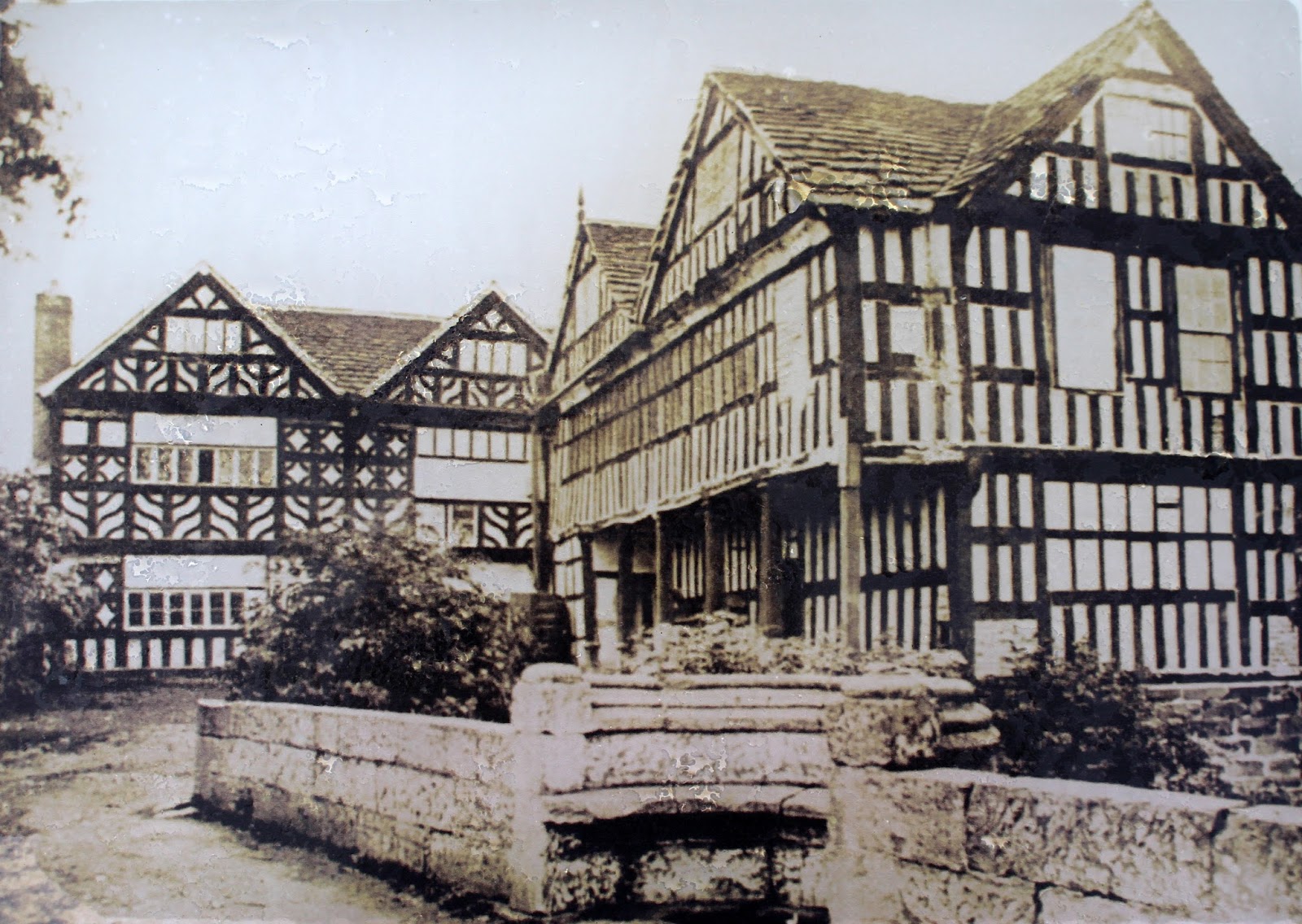
Although the footpath has been diverted around the Hall, there is a short spur here where we can get a closer view of the Hall and its lovely gardens. The half-timbered, black-and-white section of Holford Hall dates back to 1601, when it was built for Mary Cholmondeley (pronounced ‘Chumley’) after the death of her husband Sir Hugh. The section we see today was the centre of a quadrangle (see the old photo, at right), the south wing of which collapsed and was demolished in 1844. The north wing was, sadly, demolished and replaced by the current large brick structure in the 1880s. As you might guess, both this old section of the hall and the 17th-century sandstone arched bridge that spans the moat are heritage structures and Grade II listed.

Well, that peek at Holford Hall means we’ve almost reached the end of today’s walk. From here, we retrace our steps, past the old mill, over the former Roman road and homewards up the country lane. I hope you’ve enjoyed your armchair tour of Holford’s attractions.


30 January 2015

Cheshire walks: Around Pickmere Lake in the snow

Elated by last night’s dump of snow I headed out this morning to enjoy our white winter wonderland. I decided on a circuit of our local lake, Pickmere, with a slight detour to the lime avenue at Great Budworth, walking partly on the narrow country lanes and partly along some of the public footpaths that criss-cross local farmland. I’ve included a map of where I walked – the numbers mark the kilometres (this was about 6.5kms all up so quite a short wander) and the blue dots are the places where the following photos were taken (sometimes more than one at each spot) (a small selection of the 200-plus I took!). 

I hope you enjoy walking along with me – it was magical!

We start off via the footpath that runs along the top of Pickmere Lake. It's a favourite walk for local dog-owners.

Looking out across the lake. That’s the tower of the church at Great Budworth on the skyline.

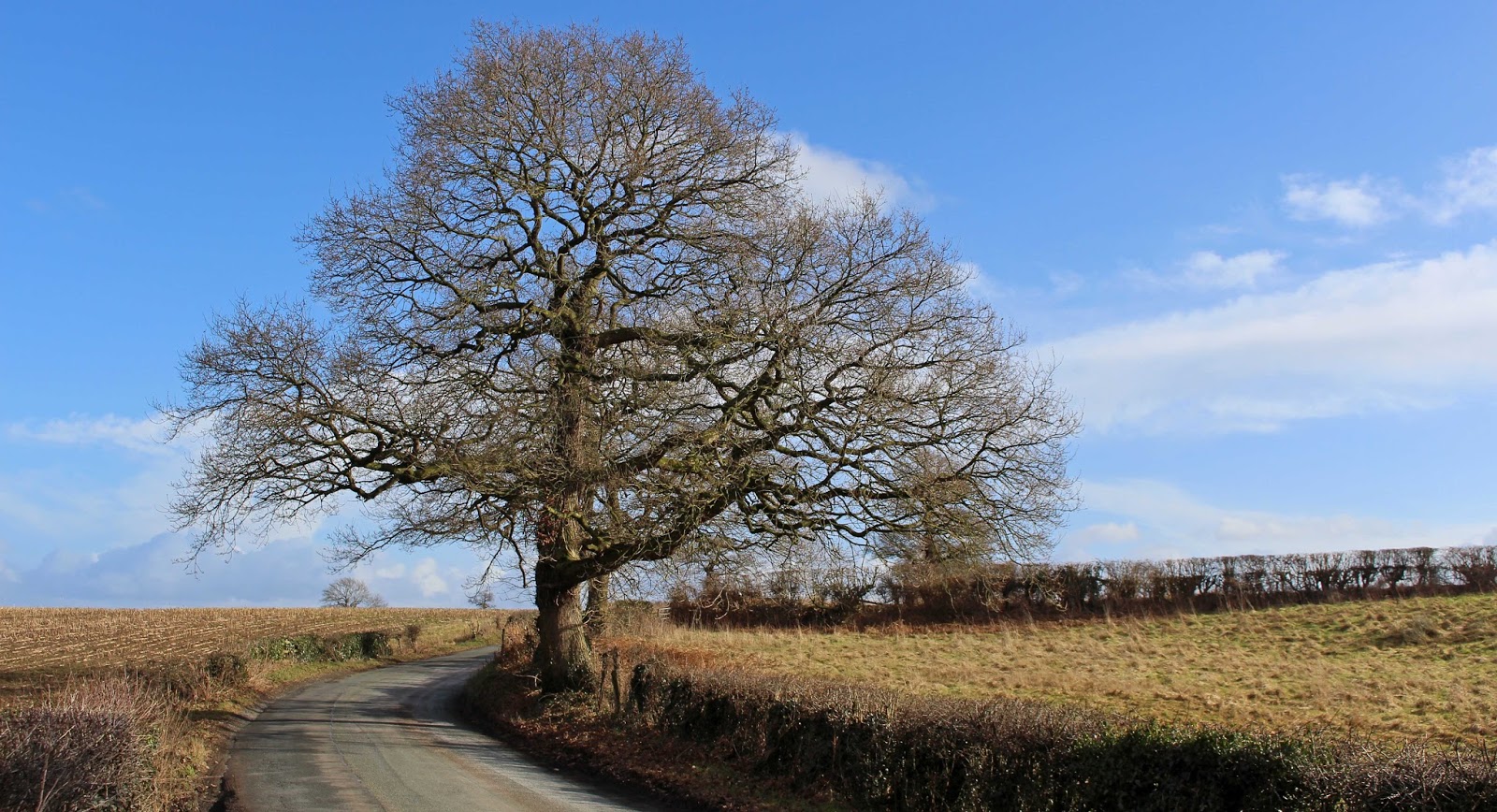
On Park Lane, looking back across the lake. This is one of my favourite trees hereabouts.

Looking in the opposite direction, over the fields towards the Millenium Wood. There’s another footpath that heads in that direction and it's also a lovely walk - another day, another blog.

The lane heads through a small section of wood called Pickmere Rough.

Three photos from this spot. The first is looking over farmer’s fields on the other side of the Rough.

And, from the same spot, looking over the fields towards Great Budworth.

And the third shot looks over the fields towards Hield House Farm. As you can see, the clouds were looking threatening at this point so I started striding out for Great Budworth.

The magnificent lime avenue at Great Budworth. It’s a long planting that runs either side of this narrow footpath. I sheltered here while a hail and sleet shower passed through.

From halfway along the lime avenue, I headed down this public footpath across the local farmer’s fields.

There are a couple of photos from points along this footpath – this first one has the lime avenue on the right and looks towards the Church of St Mary at Great Budworth.

This path is very muddy during the winter months, but was made easier today by the covering of snow, though I had to be careful not to slip!

The footpath comes out on to Hield Lane, which changes its name at the bottom of this slope to Dark Lane (the border between neighbouring councils runs through at this point, changing from Cheshire East to Cheshire West and Chester).

Looking back towards Pickmere Lake, along one of the streams that feeds into it.


On Dark Lane now, looking back toward Hield Lane and Hield House Farm.


And my last shot for today, taken of my favourite trees in Earle’s Lane, before I headed home to dry my wet feet and warm up with a hot cuppa. I hope you enjoyed my stride in the snow as much as I did!