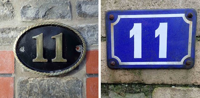
In my previous blog, House numbers, 1 to 10, I covered subjects like the design, layout, and materials used to create the numbers people have attached to their houses. This time I want to look at the back story of house numbering, while also displaying more of the attractive numbers I’ve found during my local exercise walks.
As is surely obvious, giving a house a number and a street a name makes it much easier to locate that house, yet house numbering does not exist everywhere in our world. In some places, houses are identified by name rather than number; in other places, they have both name and street number; and, where numbers of residents are low, neither system exists.
To add to the potential for confusion, even where numbering systems are used, there are variations in those systems. Some streets may have odd-numbered houses on one side of the street and even numbers on the opposite side but there are also places where houses were only planned for one side of a street and so those numbers are consecutive. When the other side of the street was subsequently built on, the numbers were not changed to an odds-and-evens system – they simply continued in consecutive order along the other side of the street.
As for the history of house numbering, Wikipedia has a seemingly well-researched article that gives 1512 as the earliest known numbering system, which was in a suburb of Paris, France, but it was until the 18th century that official numbering systems were introduced in various locations across Europe.
In Britain, according to a post on The British Postal Museum and Archive blog, the first known instance of house numbering dates from around 1708, when Edward Hatton’s two-volume publication A New View of London, or An Ample Account of that City in Eight Sections stated that the houses in Prescott Street, Goodman’s Fields were identified by number rather than name. That seems to have been a local idiosyncrasy, however, and it wasn’t until 1766 that two Acts of Parliament were passed that included house numbering, though only in two very specific locations, the Borough of Southwark and the City of London (Act 6 Geo III c24 and Act 6 Geo III c26, both dated 1765 but not enacted until the following year – see comments by John Copeland and others on the British Postal Museum blog referenced above). And even that legislation may not have made numbering compulsory – an article on the maps.thehunthouse.com website questions the wording of the legislation: the use of the words ‘shall and may’ rather than ‘must’ may indicate that usage of the numbering system was optional.
Although other towns and cities no doubt recognised
the advantages of, and adopted, similar numbering systems in the latter part of
the 18th century, it wasn’t until 1855 that the Metropolitan Management Act
decreed a more comprehensive and all-encompassing system of controlling and
regulating the names of streets and the numbers of houses.
No doubt it took some time to instigate the changes this Act stipulated, time to design and manufacture street and house signage, to allocate and map logical numbers, to inform everyone of the new labels and encourage their use. But, as the new numbering systems came into effect, I’m sure postal delivery workers collectively heaved a massive sigh of relief as their task of finding the correct locations for their deliveries was progressively made much more straight forward.


