Showing posts with label public footpath. Show all posts

11 March 2015

Cheshire churches: St Mary’s in Great Budworth and St Oswald’s of Lower Peover

One of the lanes I regularly walk follows an ancient footpath used by local parishioners to commute between two historic places of worship, the mother church of St Mary and All Saints in Great Budworth and one of her parochial chapelries, St Oswald’s Church in Lower Peover, a walk of about six miles.

St Mary and All Saints, Great Budworth

In Saxon times … the huge but thinly populated parish of Great Budworth … stretched all the way to Lower Peover and Allostock. It is likely that burial of the dead took place in Lower Peover at an early date, but baptisms and marriages were for a long time conducted only at Great Budworth. The natural way from Peover to the parish church would be following the course of the Peover Eye [a stream], itself probably a highway in heavily forested Celtic times. … The church at Lower Peover dates from the 13th century and the font for baptism dates from 1322, but it was not until about 1570 that St Oswald’s was licensed for marriages. Up until then, wedding parties would have to walk (or the wealthier ones ride on horseback) along this path.

The churchyard at St Mary and All Saints


This imposing building is one of the largest parish churches in the Diocese of Chester and the mother church of the rural Deanery of Great Budworth. There has been a religious presence on this site since at least the late eleventh century, as a priest is mentioned in the Domesday Survey, but the building we see today dates from the fourteenth, fifteenth and early sixteenth centuries, when the church was considerably enlarged. 

Once the property of the Augustinian Canons of Norton Priory, the church was taken over by Puritan ministers preaching radical Protestantism during the sixteenth-century Reformation and then changed again, to Anglicanism, during the seventeenth century.


One of the things that fascinates me about this, and many other old churches, is the proliferation of heads adorning the walls, both inside and outside the building. As you can see from the photos, some are realistic (perhaps the personifications of biblical figures used to educate the illiterate), others fantastical (like the grimaces of sinners sentenced to an eternity of hellfire and damnation, intended as a warning to the parishioners). Amongst the many treasures contained in St Mary’s, there is also the rather worn and much-graffitied alabaster effigy of the Sir John Warburton who died in 1575, one of the Warburtons of Arley Hall who owned much of Great Budworth from 1469 right through to the 1940s. 

The entrance to St Mary and All Saints


St Oswald's


Though the half-timbered part of the building and the sandstone tower were built in the 1500s, there has been a church on this site in Lower Peover (pronounced Peever) since at least 1269 when Richard Grosvenor of Hulme Hall built a Chapel of Ease here. Though the aisles were altered and reroofed in the 1850s, the building is still an outstanding example of a medieval oak-framed church, and it also contains sixteenth-century furnishings and all manner of old relics, statues and plaques.

One item that particularly caught my eye was a huge old wooden chest, measuring 6 feet long by 2 feet wide, lying on the floor in the south aisle. Above the chest was a sign:

The ancient dug-out chest was brought here from Norton Priory in 1269 for the safe keeping of vestments, plate and books. It is just the trunk of some mighty oak, roughly hewn out, and bound with wrought-iron bands. The four padlocks are of later date, and testify of the days of the four churchwardens, each of whom had a key, so that the ‘safe’ could not be opened unless all four were present. … Legend has it that any maiden who aspired to dignity of a farmer’s wife should first prove her worthiness by throwing back the lid with one hand.

Looking at the chest, the maidens must have been extremely strong in days gone by as that lid must weigh a ton! The church website explains, ‘It is believed that this tale originated because it was said that a farmer’s wife in those days needed to be strong enough to be able to lift the famous Cheshire cheeses made in the area.’ 


Just as the chest is a silent witness to the history of this holy place, so are the headstones in the surrounding graveyard, a well kept and peaceful haven that was also interesting to explore. The antiquity of some of the gravestones fascinated me and led me to wonder about the stories of the people buried there. What a wonderfully tranquil place to spend eternity!


24 February 2015

Cheshire walks: Holford Mill, Moss and Hall

Get your walking shoes laced up, we’re heading out for another walk. There’s a nip in the wind so don’t forget your hat and gloves, and tuck your jeans into your socks – after the recent rain, it could be a bit mucky in places. Today I can promise you some good exercise (we’ll be walking about 8kms), peppered with a few snippets of interesting history and garnished with trees, lots and lots of lovely trees.

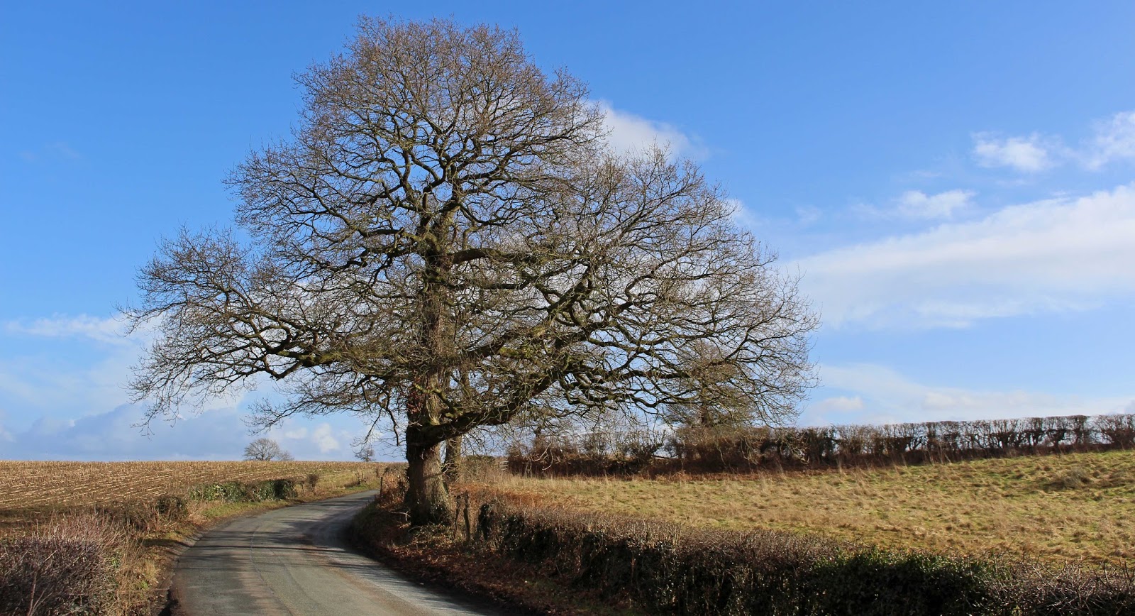
From the house we head down a typical Cheshire country lane, which would once have been part of the pedestrian route for local parishioners between the church at Great Budworth (where baptisms and marriages were conducted) and the 13th century church at Lower Peover (where the dead were buried). It always amazes me to think people have been walking these paths for hundreds of years.


At the end of the lane, we cross the main road, the former Roman Road of Watling Street, and head into more local history. To our right is the former Holford Millkeeper’s house, now a private residence – and currently for sale, if you have a spare £750,000. It’s certainly a lovely setting, though a bit noisy for me, and I’d need to win the lottery to afford it.


Just down the lane we can see the remains of the mill, which was built originally in 1324 and finally closed in 1950. There’s not much left now but under the moss and ivy you can still see the remains of the two wheel pits, either side of the mill building, plus pieces of the iron wheels and wooden shafts. It must have been impressive in its heyday.

The footpath here has been diverted from its original route through the middle of Holford Hall farm yard, to give the current owners some privacy, and now runs through woodland growing on an old lime bed, which itself sits on top of medieval fish ponds. According to the signboard, the site was ‘filled in by the Imperial Chemical Company in the 1940s. Lime beds were created for the disposal of ash and lime, a by-product of the soda ash industry’ but more on that, and other local industry, in a future blog.

The diverted path is pleasant enough, with views across a field to Holford Hall, though we’ll get a better view of that later. Firstly, though, we're going to head around this small wooded area, the rather grandly named but seemingly unofficial Plumley Nature Reserve. Though entry doesn’t seem to be encouraged, there are a couple of paths in to the reserve and I have ventured in – what I found will also feature in my forthcoming industrial blog post.

We’ll cross the railway line here, and head first left, then right along sealed roads until we get to the Holford Brinefield offices. From here, we leave behind the ugly industrial workings of the brine industry that have scarred this landscape and, turning left again, we head along a footpath across a couple of fields to reach Holford Moss.


The moss is, in fact, another scarred landscape, once used by local tenant farmers for cutting peat – you can clearly see where chunks have been carved out of the ground, though all is now covered by low scrub and bracken. A mixed woodland has grown up on the old peat cuttings, dominated by birch but with oak, Scots pine and holly trees also growing well. It’s a tranquil place for a wander and, to me, has a very ancient feel, though the peat cutting may well have continued into the 20th century.


At the end of the path through the moss, we head left at Keeper’s Cottage, along another field-edge footpath that will soon have us back at the railway line. I love the lead up to the narrow old bridge that crosses the line – I can imagine farm labourers, horses and carts, and shepherds with their flocks of sheep all using this route in times past. We cross another field and skirt round the edge of one more before we reach the long gravel driveway that leads us back to Holford Hall.


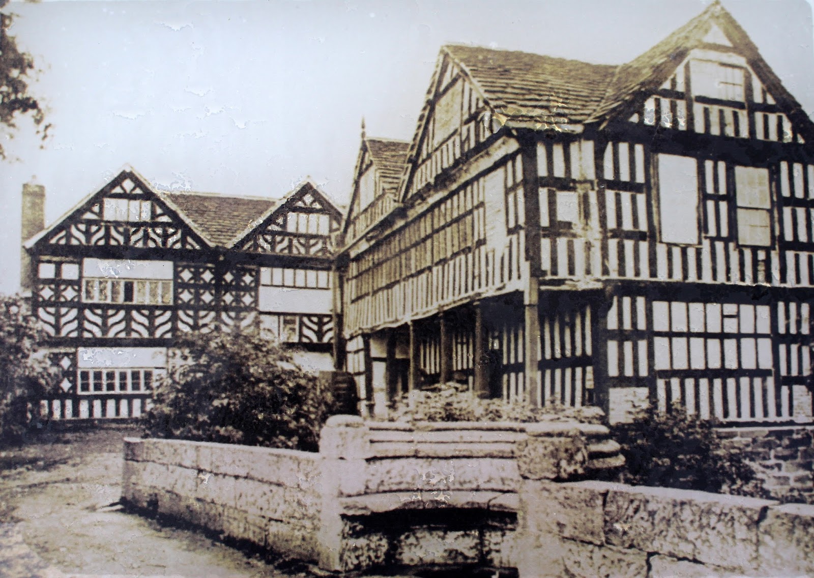
Although the footpath has been diverted around the Hall, there is a short spur here where we can get a closer view of the Hall and its lovely gardens. The half-timbered, black-and-white section of Holford Hall dates back to 1601, when it was built for Mary Cholmondeley (pronounced ‘Chumley’) after the death of her husband Sir Hugh. The section we see today was the centre of a quadrangle (see the old photo, at right), the south wing of which collapsed and was demolished in 1844. The north wing was, sadly, demolished and replaced by the current large brick structure in the 1880s. As you might guess, both this old section of the hall and the 17th-century sandstone arched bridge that spans the moat are heritage structures and Grade II listed.

Well, that peek at Holford Hall means we’ve almost reached the end of today’s walk. From here, we retrace our steps, past the old mill, over the former Roman road and homewards up the country lane. I hope you’ve enjoyed your armchair tour of Holford’s attractions.


13 February 2015

It’s a sign: England, part two

When out for one of my countryside rambles recently, the realisation that I was just a tad lost finally dawned on me when I saw this sign on a side road.

Low-flying aircraft
As far as I was aware, I shouldn’t have been anywhere near an airport. Turns out I wasn’t too far from a rather large, now abandoned airfield, former Royal Naval Air Station Stretton or HMS Blackcap. According to the Forgotten Airfields website it was built as a Royal Air Force night fighter station to protect Manchester and Liverpool from Luftwaffe raids during the Second World War but transferred to Admiralty control when the Germans stopped bombing British cities. The Navy had 41 Fleet Air Arm Squadrons based at Blackcap for varying periods, flying regular missions to and from aircraft carriers based in the Irish Sea.

Construction of the M56 motorway in 1971 went right through the site, half of which is now an industrial area but the south side is still very obvious in this aerial photo. In recent years, apparently, Shell used the airfield to test engine oil but it seems currently to be languishing unused. The Warrington Guardian of 11 June 2014 reported on plans to turn part of the land into an underground vehicle storage facility but that is being opposed by local councils, and car-racing enthusiasts have been eyeing the site for a race track, something neighbours have also opposed.

I’m assuming the sign has been there for a long time – I don’t think there have been any low-flying aircraft in the vicinity since the airfield closed in 1958!

The Pinfold
‘This enclosure dates from the Eighteenth Century and was used as a pound to secure stray livestock.’

You never know what you might stumble across when out walking! First an airfield and then, on that same long rural meander, something much much older. I discovered this enclosure and its explanatory sign on Budworth Road, not far from Arley Hall, in Cheshire. I’d never heard the word pinfold before so, when I finally got home, I hastened to google to discover more. Professor Wiki notes that the terms ‘pinfold’ and ‘pound’ are both Saxon in origin and both mean ‘animal enclosure’ – the only difference in usage is which part of England you’re in: it’s a pinfold in the north and east and a pound in the south and west.

Due to its age, this pinfold is a Grade II listed structure. It’s of ashlar contruction with large coursed stones, is rectangular in shape, with walls just over 100cms tall and has a single entrance. Dating from the days before enclosed fields were in common use, it would have been used to house stray pigs, sheep and cattle until their owners reclaimed them.


Signpost to Arley
‘This Road Forbidden Is To All / Unless They Wend Their Way To Call / At Mill, Or Green, Or Arley Hall.’

Having mentioned Arley Hall above, I thought I’d also include this rather wonderful signpost in this blog. The sign marks one of the side entrances to Arley Estate, an entrance only for use by those who reside in the old houses along the lane or those on foot, intending to walk the local public footpaths. If you’re not familiar with Arley, it’s a magnificent country estate that has been home to members of Lord Ashbrook’s family since the fifteenth century. 


So far, I’ve only been able to view Arley’s glorious vistas from the public paths as the house and gardens have been closed over the winter but I’m planning on exploring further when the 2015 visitor season opens in March. 


Footpath signs
As you’ve no doubt gathered, both from the name of my blog and from the numerous times I’ve mentioned my rambles and meanders, I’m a very enthusiastic and active walker. One of the things I like best about living in England is the public rights of way that make this country’s green and pleasant lands easily available to everyone. They give access to places you could never reach by road, allow you to appreciate the sounds of Nature not motorways and, as some are hundreds of years old, they provide valuable insight into the history of the people who have lived in the area.

There are various types of rights of way: public footpaths, for pedestrians only; public bridleways, for horse riders and pedestrians to share; and restricted byways, for horse riders, pedestrians and non-mechanised vehicles (the horse and cart of olden times) to share. Walkers can also often use concessionary paths, where use is allowed at the discretion of the landowner but is not a legal right. These are often also called permissive paths (which always makes me chuckle!).


The signage for these paths varies from place to place and from county to county so I have included several different examples here. 

As the sign below reminded me, you do have to be mindful of track boundaries when using footpaths (though this warning of potential shooting is a rather extreme example!) and you should always always follow the Countryside Code


30 January 2015

Cheshire walks: Around Pickmere Lake in the snow

Elated by last night’s dump of snow I headed out this morning to enjoy our white winter wonderland. I decided on a circuit of our local lake, Pickmere, with a slight detour to the lime avenue at Great Budworth, walking partly on the narrow country lanes and partly along some of the public footpaths that criss-cross local farmland. I’ve included a map of where I walked – the numbers mark the kilometres (this was about 6.5kms all up so quite a short wander) and the blue dots are the places where the following photos were taken (sometimes more than one at each spot) (a small selection of the 200-plus I took!). 

I hope you enjoy walking along with me – it was magical!

We start off via the footpath that runs along the top of Pickmere Lake. It's a favourite walk for local dog-owners.

Looking out across the lake. That’s the tower of the church at Great Budworth on the skyline.

On Park Lane, looking back across the lake. This is one of my favourite trees hereabouts.

Looking in the opposite direction, over the fields towards the Millenium Wood. There’s another footpath that heads in that direction and it's also a lovely walk - another day, another blog.

The lane heads through a small section of wood called Pickmere Rough.

Three photos from this spot. The first is looking over farmer’s fields on the other side of the Rough.

And, from the same spot, looking over the fields towards Great Budworth.

And the third shot looks over the fields towards Hield House Farm. As you can see, the clouds were looking threatening at this point so I started striding out for Great Budworth.

The magnificent lime avenue at Great Budworth. It’s a long planting that runs either side of this narrow footpath. I sheltered here while a hail and sleet shower passed through.

From halfway along the lime avenue, I headed down this public footpath across the local farmer’s fields.

There are a couple of photos from points along this footpath – this first one has the lime avenue on the right and looks towards the Church of St Mary at Great Budworth.

This path is very muddy during the winter months, but was made easier today by the covering of snow, though I had to be careful not to slip!

The footpath comes out on to Hield Lane, which changes its name at the bottom of this slope to Dark Lane (the border between neighbouring councils runs through at this point, changing from Cheshire East to Cheshire West and Chester).

Looking back towards Pickmere Lake, along one of the streams that feeds into it.


On Dark Lane now, looking back toward Hield Lane and Hield House Farm.


And my last shot for today, taken of my favourite trees in Earle’s Lane, before I headed home to dry my wet feet and warm up with a hot cuppa. I hope you enjoyed my stride in the snow as much as I did!